
Trucks are banned from downtown Suffolk.

US 460 Business leaves VA 32 here, and US 13 Business joins it. US 58 Business actually runs both ways here.

Heading eastbound on VA 337, Washington Street, which is the true east end of VA 10.

This was the second VA 337 shield I saw. I missed the first one.

Old Norfolk and Western underpass with a separate tunnel for pedestrians. Cool!

Suffolk has several of these curve signs with the advisory speed in the sign itself. This was the first one I saw.

VA 337 meets US 58/460 Business, which is just posted as US 58. I'm not sure if this is also US 13 Business or not.

LGS trailblazers at the intersection.


Beginning east down US 58/460 Business.

Joining the expressway, which gains the Portsmouth Boulevard name.


It's always closed!

Approaching I-664, which isn't yet mentioned. Somewhere near here I entered Chesapeake.

There it is. Well, sort of.


The LGS on the left says US 460 ALT.

These both said 28 minutes.

I-664 trailblazer.

I-664 is numbered sequentially and backwards. If its exits are to be renumbered according to mileage, this would be exit 1 or 0. So which way did I go?

I took I-264.

Entering Portsmouth.

Hampton Roads does Clearview much less awfully than Richmond, but it still uses it in exit tabs, which is not legal.

Victory Boulevard is VA 239, but like most primary routes on I-264, its shield is not posted.

VA 337 is one of the few whose route number is mentioned.


As is VA 141, at least eastbound.


Nearing the tunnel.


Descending into the Downtown Tunnel between Portsmouth and Norfolk.


Emerging from the tunnel in downtown Norfolk.

Heading away from downtown.

Approaching the secret VA 405, Ballentine Boulevard. More from VA 405 in part 5.

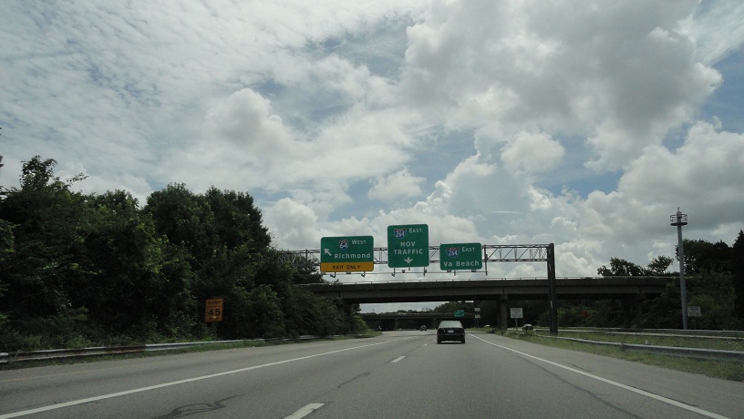
I-264 approaches its parent again.


Until 1999, I-264 ended here and VA 44 took over to the oceanfront.
Newtown Road is VA 403. Again, more from that road later.

Now in Virginia Beach, where I'll stay until the end of the entry.

Independence Boulevard north of I-264 is VA 225.


Rosemont Road was VA 411 from 1982 to 2001. It was never posted.

Leaving I-264 at Lynnhaven Parkway, which was VA 414 from 1982 to 2001. Like VA 411, it was never posted.


Side Avenue of British Road Enthusiasts. From here I met Elric at Lynnhaven Mall and we resumed the trip after lunch.

Heading towards a Best Buy, and ultimately VA 165, we see these lighted street blades.

Approaching VA 165, Princess Anne Road.


VA 165 is in the process of being expanded to four lanes.

Wait a minute...

Yeah, more rain.

I was trying to photograph trailblazers for VA 165 and VA 149 in this photo. It didn't work out well.

Atrocious street blades at the corner of VA 165 and VA 149.

From here it started raining too hard for me to be able to drive and take pictures, but Elric made a video of it.
After the rain, in the much more rural Back Bay area of Virginia Beach. There's a VA 615 shield somewhere behind the raindrops on my windshield. Of course, VA 615 doesn't exist, and Princess Anne Road hasn't been secondary route 615 since 1963.

Getting closer to the border.

The Virginia Byway ends at the border.

Part 3, where we're in North Carolina, is coming soon. For now, you can see Elric's photos of this area and Knotts Island.
No comments:
Post a Comment