I began my journey taking I-95 to unsigned US 460, Wagner Road in Petersburg. Just east of I-95 is a signed junction for frontage road 330. Frontage roads usually are just signed with white rectangles, but a few in the Petersburg area, particularly F330, have shields at major intersections.

US 460 turns from Wagner to County Drive and meets I-295 shortly after leaving Petersburg. Here we see yet another ground-mounted BGS.

Just after I-295 is New Bohemia and this Speed Limit 45 sign. The speed limit had been 40 before here.

After New Bohemia is what I like to call The World's Most Depressing Stretch of US 460, due to its recently lowered speed limit (seen here) and depressing billboards.

The World's Most Depressing Stretch of US 460 ends at Disputanta, but the rumble strips go pretty much all the way to Suffolk.

Now at VA 40, in Waverly in Sussex County. VA 40 is the longest Virginia state highway, stretching from VA 10 in Surry County to VA 8 in the mountains.

Past Waverly is Wakefield, still in Sussex County. This is the south end of VA 31, which goes to Williamsburg via the Jamestown-Scotland Ferry.

Suddenly, I'm in Suffolk, approaching the bypass. These original overheads are still present.


After picking up Elric, we head south and west. Here I'm on VA 337 westbound, approaching Saratoga Street, which was once temporarily VA 32.

The last westbound VA 337 reassurance shield.

VA 337 ends at US 58 Business. Here's looking back at the first eastbound reassurance shield.

US 58 Business assumes the Washington Street name, at least for now. Here's an odd-looking reassurance shield missing the Business banner.

Crossing Lake Meade, US 58 Business becomes Holland Road, a name that goes out to...Holland.

A rare normal-looking and correct shield.

Approaching mainline US 58, which takes the Holland Road name west of this intersection and becomes the Suffolk Bypass to the east. US 13 is also here, apparently. Get used to seeing this shield style; it's Suffolk's standard now, despite being atrocious.

Most of western Suffolk is very rural.

Approaching the Holland business route.

In the 1990s, Mike Duman dealership ads used to have the slogan "The Duman can!" on them. Don't ask me why I remember that.


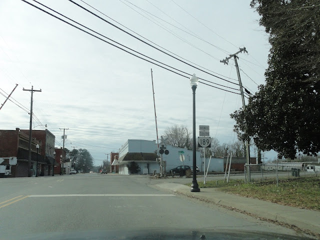
Entering Holland, US 58 comes to the north end of VA 189 (South Quay Road), which should be posted east-west.


VA 189 Business was a short-lived designation that appeared when VA 189 was moved to the Holland Bypass in the mid-1970s. It was decommissioned when US 58 took over in the 1980s and mainline VA 189 moved back to South Quay Road into Holland. Still, there's one Business 189 reassurance shield in each direction (the northbound one is hard to see from US 58 so I didn't get it), and from the look of them, they're not leftover.
VA 189 joins US 58 west of Holland and the South Quay Road name comes along with them. The speed limit is 60 MPH.

VA 272 is a former alignment of VA 189, and also South Quay Road. US 58 and VA 189 continue west as the Franklin Bypass. The VA 272 shield reminds me of Ric Ocasek for some reason.

Approaching the exit for VA 189, which leaves the bypass here, and US 258, which joins it. Before 2003, US 258 still went through Franklin and north of the bypass was VA 260.

We saw a lot of Truck banners. US 258 is signed as Business and Truck in this area.

No, VA 189 does not end here.


Heading down VA 189.

This VA 272 shield doesn't remind me of any member of The Cars.

VA 189 resumes the South Quay Road name, which it keeps until its


VA 189 uses a drawbridge over the Blackwater River. Elric got a better picture of it than I did.

After the drawbridge, VA 189 enters Southampton County.

SR 714 is Pretlow Street, and the original routing of VA 189, something you can sort of tell from this angle. It heads northwest into Franklin, making it even more confusing why VA 189 is signed north-south.

VA 189

The Blackwater River comes very close to VA 189 right here. There's a historical marker near here for the South Quay.

VA 189 meets its end at US 258.

Franklin and the NC line are each about 5 miles from this intersection.

We stopped at the gas station here.


In part 2, we'll resume our trip with US 258.
No comments:
Post a Comment