Friday, October 26, 2012

He Went To Jarratt

See what I did there?

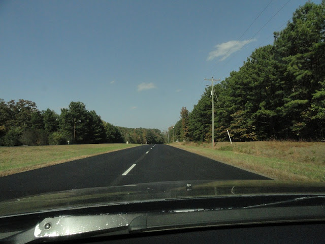
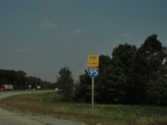
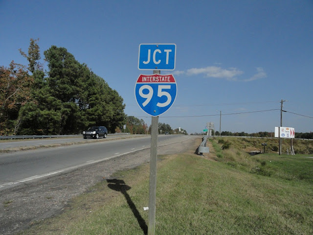
Last weekend, I got new tires for my car. Every time that happens, I always drive down I-95 to Jarratt and back to break them in. Last year I explored the state routes there, VA 139 and VA 397. This time I just took I-95 in and a brief bit of US 301 back. While on I-95, I made a video. It's long and sans commentary, so you should find some driving music while watching it. Note that the last state-name I-95 shield on the mainline from this section appears just south of Exit 31.

I got off on Exit 20 and headed to US 301, which had been freshly paved. But first, I wanted to finally see the Old Halifax Road historical marker.

Fresh asphalt.


US 301 drops to 2 lanes and becomes I-95's frontage road. It's on video up to SR 645. The planned toll booth is supposed to go on the section of I-95 seen in the video.

SR 645 is home to Exit 24 and absolutely nothing else. The shield on the right is state-named.

This shield is, too.

The US 301 shield is a 2-digit shield. And why does SR 645 have only a left arrow? It keeps going.

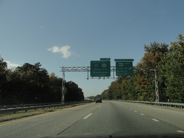
Back onto I-95. I saw this odd thing.

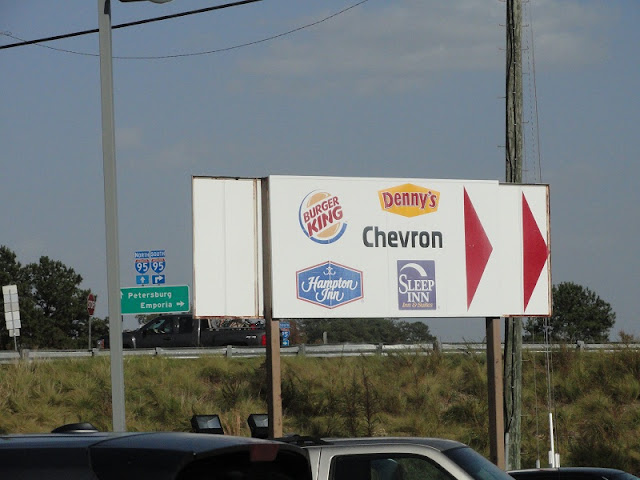
I stopped at the Davis Travel Center and took some signage photos there, including a leftover Chevron logo.

This photo was taken from the parking lot, but I took off on foot.

Plain ol' I-95 shield.

And a state-name one.

Back on I-95.


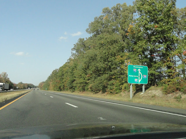
The I-295 split. These BGS's look awful.


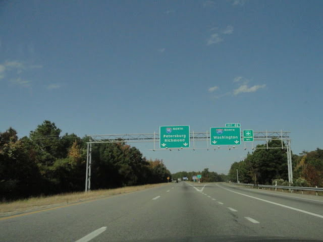
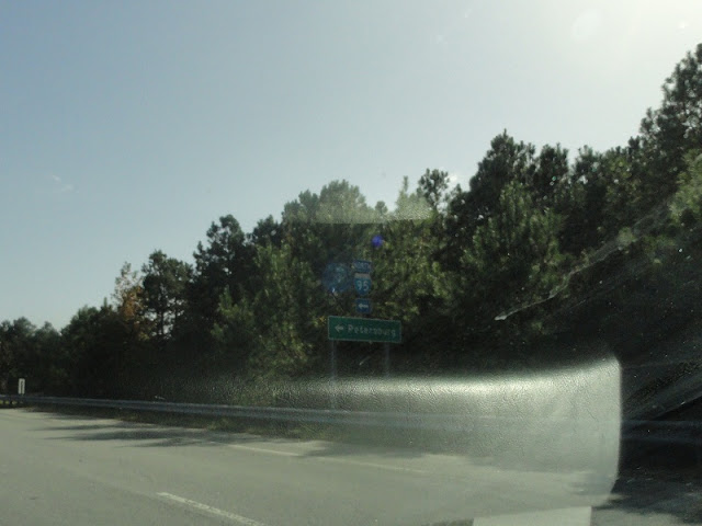
Signage in Petersburg.

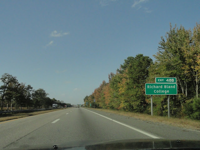
Hooray for a non-Clearview exit tab for once.

Eastbound Wagner Road is unsigned US 460, which joins I-95 northbound here.

Both of these posted routes are errors. US 460 should be US 460 Business, and VA 109 shield should have TO above it.

This isn't an error, just left over from before US 460 extended onto I-95.

As usual, I don't have much of a conclusive statement. This wasn't as much of a prepared trip as it was taking my camera while breaking in my tires, and it worked out pretty well in that case. I discovered a few odd signs I didn't know existed, so that's a plus. Before the year's out I want to take one more real trip, so we'll see where I end up next time.

Tuesday, October 16, 2012

The Richmond Road Meet, Part 4: Racing The Sunset (Again)

The last part of my road meet entries focuses mostly on VA 197, but first we have to get to it.

Exiting off I-95/64 at Exit 78, which takes you to VA 161.

Almost there...

There we go.


When we got to VA 197, we turned right and did a quick U-turn to reach these cutouts.

Our next site wasn't far away.

Three signs of interest are at the Interstate Center. The first is this original (again, 1970s) state-name I-195 unisign, the last of its kind. The numbers are normally easier to see, but I really like the lighting in this photo.

There was a randomly placed chair under the I-95 overpass. Steve ran up and sat in it.

There were also stairs from Laburnum to I-95.

Oh, and there was a white border VA 197 trailblazer. Elric's head was perfectly blocking the sun.

Steve checks out what's atop the stairs.

Richmond unisign.

The other white-border sign.

The signal on the right has only one head. If it's never going to turn yellow or red, why bother with them?

Our last site, further down VA 197. This cutout shield was interesting enough, since it has a misprinted banner and arrow, but then someone hit it with a car.

You can see the damage.

I have to think this sign's days are numbered.

Returning to Short Pump via I-195 and I-64.

The sun sets over Short Pump.

After we returned, 10 of us went to Keagan's Irish Pub, a block away from the Halligan, for dinner, while the others departed. All in all, it was a fantastic day. To those who came, once again, thank you. I had a great time, and I hope you did too. See you soon.

The Richmond Road Meet, Part 3: Downtown

Downtown Richmond has some great sites of roadgeek interest. I've never been able to spend a whole day there looking around, but what I have explored has yielded plenty of cool things, so bringing the meet here was a must. Elric, Steve, Will and I took off on foot on our own, while the rest joined us later.

The parking deck I chose was under the James Center, surrounded by Cary, Canal, 10th, and 11th Streets. We parked next to this CR-V with a brilliant stick figure family parody.

The James Center has a bell tower that goes off every half hour.

East Cary Street carries US 60 and VA 147 eastbound here. East of 11th it has cobblestone pavement, but the asphalt here is in sad shape.

The bell tower was going off at this point, 4:28 PM.

Here's the parking garage entrance.

5th gen Prelude sighting on 11th.

The last original (1970s) overhead for the Downtown Expressway has an unfortunately placed signal in front of it.

Walking up Canal Street from the overhead, we see this orange merge ahead sign. with a bit of city skyline behind it.

Looking back towards the VA 195 offramp and mini toll plaza.

Steve waits for traffic to pass before joining the rest of us on the sidewalk.

Original 1970s trailblazers.

The back thereof reveals no date codes.

We crossed 9th Street, which takes US 60 to the Manchester Bridge. No crosswalk here, by the way.


Upon reaching the sidewalk again, we saw this Panamera. It's a base model (only $80,000), so Elric wasn't impressed.

Kanawha Plaza, where we took the meet photo. The sun wasn't nearly as friendly when we did.

Steve unfolds the Send Help sign.


More original trailblazers.

Elric, Steve, and Will get ready to take photos of the same assembly.

Dominion Virginia Power's headquarters.

What's so important about this sign?

Oh, that. Yeah, I-95 isn't signed East here.

The other two signs like that have no directional banner at all for I-95.


The meet photo, taken by Will. Steve also took one, but Will's was uploaded first. Kneeling: Billy, Will, Scott, me. Standing: Oscar, Carl, Elric, H.B., Steve, Chris, Mike T, Doug, Jason, Mike P, Laura. Shawn isn't in it. Can you tell the sun was in our eyes?

Wait, that was really someone's name?

This unisign for US 60 and VA 147 has been used before, with two US shields underneath, supposedly 33 and 60.

Steve goes out into the street to take a picture of the sign...

...so everyone else follows him.

Including me.

Some sculpture.

The bell tower at the James Center was going off again, an hour after the first time.

Since time was running short, we decided to bypass some of the cutouts and head directly to Laburnum. Doug took H.B., Jason, and Billy back to Short Pump since they had reservations.

Leaving downtown, we drove past Sine, where this small sine salad is.

Oh yeah, cobblestones. Between 11th and 14th, Cary is paved with cobblestones.

Heading to Broad on 14th.

From there, we got on I-95, which wasn't quite also I-64 yet.

In the last entry, we'll pick things up after exiting I-95.