

Looks like that's less than a mile.

A big anchor in a park.

Scenery.


The official meet group photo. Left to right: MTS, Keith, me, Daniel, Brian, Mike T, Mike P, Laura, H.B., C.P., Mapmikey (standing), Froggie (kneeling), and Oscar.

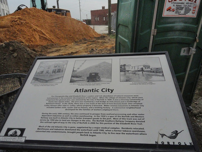
After a bit of discussion deciding who wants to do what, those of us in the cars of Froggie and Mapmikey decided to go looking around at signs in the area. Here we're leaving Atlantic City and heading onto VA 337.


Norfolk makes some horrible shields these days.

This used to be a BP, and before that it was an Amoco.

VA 337 passes Old Dominion University.

On this crosswalk, the numbers flash along with the Don't Walk sign.

Around here we have these for tractors.

After a pit stop, we briefly went onto Norfolk Naval Station to check out this grievous error for I-564.

On another section of the naval base, we saw these ground-mounted flashing signals.

Also interesting are these signs for VA 170, which was once on I-564's right of way. This gate has long since been closed, but it apparently gets used once in awhile.


"Jet Blast Area". Sounds fun.

Weird advisory speed sign/speed limit sign hybrid.

And we'll end this portion with another terrible example of Norfolk signage.

Up next, the final entry from the meet. The last photo contains a clue of where we'll be headed.
No comments:
Post a Comment