Some background on VA 13: Virginia has several state primary routes that have the same number as a US route, serving as an "extension" of said US route from where AASHTO and/or FHWA designated its end. Arguably the most notable "extension" route in Virginia is VA 33, which extends the 33 designation from Richmond to Deltaville. There are others: VA 211 and the bizarre VA 360 are the only other two extant ones that still pair with their US route, while VA 121 and VA 311 are remnants from those US routes being in the state. Also, US routes 501, 17, and 258 are among those whose extension route has been renumbered (501 as VA 39, 17 to US 17 and VA 287, and 258 to US 258 and some secondary routing). There are two state primary numbers that are duplicated with an unrelated US route in Virginia: the unsigned VA 48 (the internal designation for the Blue Ridge Parkway and Skyline Drive) and VA 13. US 48 in Virginia is a relatively new thing, but the US/VA 13 paradox has existed since the 1930s, when the original VA 13, a much longer version containing the current one's routing, was eliminated due to both its number and almost its entire routing being shared with a US route. However, the signs are thought to still been up for much longer after that, due to the sheer number of routing changes in the 1933 renumbering. In 1934, according to Mapmikey of the Virginia Highways Project, US 60's bypass of Powhatan was completed and the old route through town, referred to as "Old Route 13" was kept in the primary system. The next year, the rest of US 60's straighter path between Powhatan and Cumberland was completed, and VA 13's current form was completed. In my opinion, VA 13 should be renumbered to VA 12, as the latter number hasn't been used since 1954. It could have been done in 1935, when the 1933 version of VA 12 was upgraded to US 220, but the number went to most of current US 340 until '54. Anyway, onto the photos...
Getting of VA 288 onto US 60 westbound west of Midlothian, approaching Westchester Commons and the Watkins Centre. VA 13 is still about 15 miles away.


While there, I stopped at CVS 4242 and got a drink. They had these Angry Birds gummies. What does this have to do with roads? Absolutely nothing.

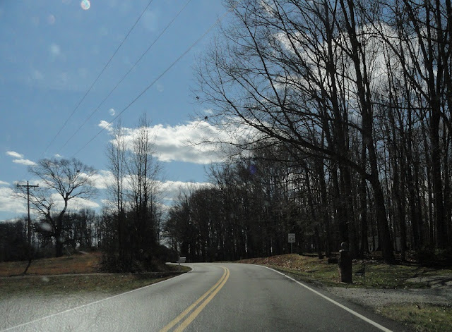
Back on the road, somewhere in eastern Powhatan County.

Approaching SR 603, which is the same SR 603 that has the white border US 360 unisign many miles south.


Just after SR 603 is the east end of VA 13. I couldn't zoom because there was traffic behind me. Of course there would be.


Beginning down VA 13 is this old, non-reflective reassurance shield and distance sign, but of course the shot was blurry. Still, it was noteworthy enough that I felt the need to keep the photo.

VA 13 is quite a curvy road, which is probably why US 60 was removed from it.

Approaching Powhatan Courthouse. The speed limit drops from 55 to 35.


Coming up on a traffic circle near the county's administration buildings.


At the courthouse proper now. The road to the right leads to the useless VA 300Y...

...while the road to the right here is the unposted south end of VA 300.

Leaving the courthouse area to parallel US 60 for a bit.


In the background here is VDOT's Powhatan residency.


Really close to US 60 now.


Approaching the SR 1002 intersection. SR 1002 is a short connector between VA 13 and the US 60-522 intersection. You'd think I'd be more enthusiastic about the end of a US route, but I'm not a fan of US 522. Side note: The light on the Stop Ahead in this first photo isn't flashing; it's holding on the right side.


VA 13 goes off on its own for awhile now. Also, the rumble strips in the yellow lines begin.


Between Macon and Ballsville.


Approaching Ballsville. The rumble strips don't go past here. My dad worked on repaving VA 13 and said the repaved sections didn't get the rumble strips back.


Leaving Ballsville, going towards Tobaccoville.


Approaching Tobaccoville.

I'm not sure what in the world happened here. At first I thought one of those bizarre VA-interstate hybrid looking shields from Virginia Beach somehow migrated to Powhatan, but then I noticed the arrow covers the top of the shield. Either way, SR 681 is the former north/west end of VA 38, but more on that later.

Just past old VA 38.

Now in Cumberland County.


This is approaching Cumberland SR 621, Brook Hill Road. The height restriction is 9'0"!

Yeah, it's unpaved.

VA 13 in Cumberland is a nicer route than its eastern counterpart, but seemingly less used.


Approaching SR 682, which was VA 45's routing from its inception in 1928 to about 1935 when the new US 60 was completed.

Between SR 682 and US 60-VA 45.

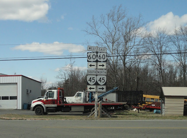
Approaching US 60-VA 45, VA 13's west end.


Eastbound US 60 and northbound VA 45. Now heading back to SR 682 to alignment-clinch VA 45.

Approaching VA 45 and SR 682.


SR 682 doesn't look like it's changed much since its VA 45 days.

Heading back onto VA 13.

Re-entering Powhatan County.


Back at SR 681. This was VA 38 from 1940 to 1954. Before that it was part of VA 49 when that route was at its maximum length.

This distance sign is for Morven, Amelia, and Scotts Fork.

You can see old 38 doesn't get much use aside from locals.


Entering Amelia County.


Aproaching SR 616 (old VA 149) in the Morven area. SR 616 isn't posted southbound on 681.

Back to winding through the woods.

Old 38 is a much nicer route in the Truxillo area. Now briefly heading eastbound before it turns south again.

Approaching SR 656 (old US 360).

Now south of old 360 approaching the current version.


Just after the end of SR 681 is the west end of US 360 Business for Amelia.


Beginning down US 360 Business. Just before the bridge is a frontage road called Frontage Road Lane.

Approaching Amelia.

VA 38's current west end.


VA 38 has several turns through Amelia.


Approaching SR 614, which goes north to US 360 Business and south to Blackstone.

Now past all the turns and heading towards Scotts Fork.


Originally VA 38 continued straight here. Its old alignment is still partially present, and is accessible via that road with the stop sign. It was moved to create a 4-way intersection with SR 602.

VA 38 approaching Scotts Fork and VA 153.

After a brief pit stop and drive down VA 153, the old VA 38 routing resumes with SR 708.


Something I noticed about old VA 38 is that it's still posted with distance signs even though it's long been secondary. I did see some turned-aside distance signs further down 708, though.

708 is briefly Cralles Road, but becomes Namozine Road and continues with that name until its east end. Namozine Road continues as SR 615 out to Jennings Ordinary.


Approaching Mannboro, where 708 has a brief jog with SR 612.

SR 612 is called Richmond Road because it was initially intended to be the route of VA 153, which once connected to US 360 in the Brandermill area, but the current route was built instead.

Leaving Mannboro.


I don't know why this road isn't primary anymore!


The long-abandoned Namozine Grocery, which has apparently been gone for enough years for a full forest to grow where it once was. Or maybe it's still there and hidden behind those trees somewhere.


Back to nothing for awhile. Somehow there was a vehicle behind me the whole time.


Entering Dinwiddie County, over Namozine Creek.

Still not many signs of civilization yet.

Approaching SR 611. Some signs of life now.


Small though they may be.


Approaching SR 623, which loops around and meets 708 again back in Amelia somewhere. I just missed it.

SR 601 is River Road, which takes you to SR 600. 600 takes you to either Matoaca or VA 226 at Edgehill.

Going over a railroad to meet US 460.

SR 708 ends at US 460. This was also the east end of VA 38 from 1933 to 1951.

Now on I-85/US 460 heading home. There are several US 460 cutout shields on this section, in both directions, but this is not one of them.

So there you have it, a much more comprehensive, but not perfect, look at VA 13 and the past and present of VA 38. For March, I'll be headed to the Southside again.
No comments:
Post a Comment