The first route I wanted to drive was VA 161, which meanders mostly north-south through the city under several names. Here I'm on I-95, five miles away from its south end, where it's first mentioned.

Getting closer to the exit now. This is just past the VA 150/895 interchange. The exit lane for VA 161 has become continuous with the entrance lane from VA 895, and the greenout on the bottom of this overhead used to say "Exit Only".


Almost there...

There we go.

VA 161 begins as Commerce Road. The standard Virginia shield is uncommon in Richmond, as you'll soon see. Also, notice the I-95 shield in the sign at the traffic light.

This is what most route postings in Richmond look like; the infamous Richmond unisign. I actually like them, but I'm in the vast minority. VA 161 prepares to leave Commerce Road for Bells Road, which is posted as West Bells Road at the traffic light in the background here.

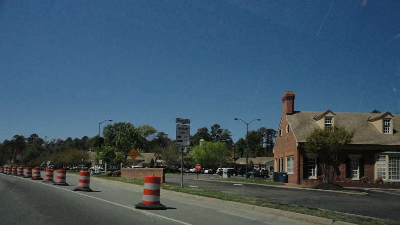
Beginning up Bells Road. This is where the headquarters for Phillip Morris USA is located.


And you thought flavor country looked like the wild west.

Bells Road leaves the Phillip Morris facilities past this railroad crossing and becomes more residential.

Crossing US 1/301 now, with more normal shields for those routes. VA 161 used to end at US 1/301 until 1994, but it used Terminal Ave instead of Bells Road.

Past US 1/301, VA 161 gets ready to change roads again, turning onto Belt Boulevard here. Bells Road ends at this intersection; Warwick Road, which was completed about 10 years ago, continues straight ahead.


Beginning up Belt Boulevard. The first VA 161 reassurance shield is past Terminal Avenue. Of course, I missed it.

VA 161 goes under Hopkins Road, the first of two interchanges on Belt Boulevard.

VA 161 intersects VA 10, and the two routes have a brief concurrency.


Just past the northern VA 10 intersection, VA 161 continues as Belt Boulevard to meet US 360.

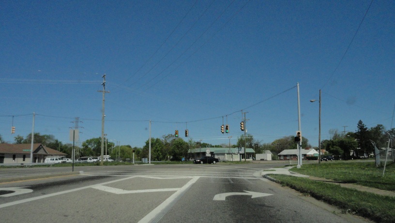
The 161-360 intersection has ramps, but no grade separation.

Past US 360, VA 161 becomes a 5-lane road, with overhead lane diagrams.

A Mobil station. There aren't many of these around here anymore.

VA 161's second interchange, and the only "full" diamond, is with US 60.


Another signal with only two segments. Notice that southbound it's fully green-yellow-red.

VA 161 changes names from Belt Boulevard to Westover Hills Boulevard as it enters the upscale parts of Richmond.


Descending to the Boulevard Bridge, which VA 161 uses to cross the James River.

The Boulevard Bridge's nickname is the Nickel Bridge because the toll used to be a nickel. Now, not so much.

On the bridge.

The toll booth is on the north side of the bridge. Past here is Byrd Park.

The top sign in this photo is a VA 161 trailblazer with the arrow pointing straight. It's completely faded to black. The bottom sign is for Dogwood Dell.

VA 161 changes from Park Drive to Blanton Avenue here.


Now VA 161 is simply called Boulevard. Here I'm just past VA 195, which becomes I-195 just west of here. Check out that Prelude in the bottom right corner!

VA 161 meets eastbound VA 147, Cary Street. VA 147 is split here.

Looking towards Carytown, a shopping district. Its boundaries are here (east end) and I-195 (west end) on Cary Street.

To the left here is the Virginia Museum of Fine Arts and the secret VA 315, which I inadvertently clinched last year when my car overheated.

Cutout shield! Also, a parking violation.

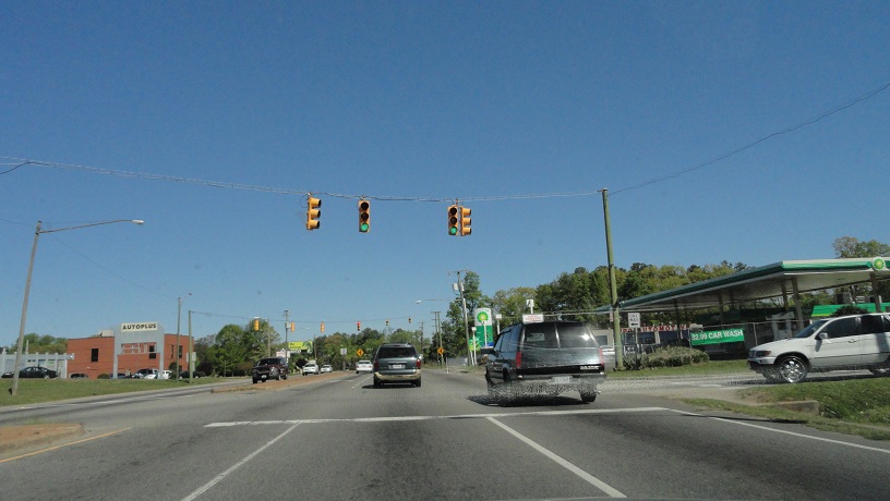
VA 161 meets US 33 and 250, West Broad Street. Richmond can't seem to get US 33 and VA 33 right. I have to think if the non-US portion had stayed VA 4, this confusion wouldn't occur. After all, US 250 used to be VA 5 and Richmond never gets their shields confused.

The Diamond, Richmond's mid-80s vintage baseball stadium. Currently home to the AA-level Richmond Flying Squirrels; formerly the home of the AAA-level Richmond (now Gwinnett) Braves. I could go on about Richmond baseball, but I'll spare you.

Just past The Diamond, VA 161 meets I-95 again, as well as I-64 which isn't posted here.

VA 161 gets ready to change names again, becoming Hermitage Road. It keeps this name until it leaves Richmond.

The first of several US Bike Route 1 shields you'll see in this entry.

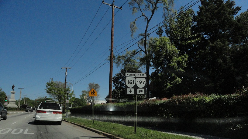
Approaching the VA 161-197 intersection, which is the south end of the Hermitage Road Historic District.

That's the AP Hill Monument in the middle of the intersection. Hill was a Confederate Civil War general from the area, and is buried there. More from this intersection later.
Entering the Hermitage Road Historic District.

VA 161 has one last interchange with I-95. Well, it's actually a half-interchange: I-95 has only a southbound entrance and northbound exit, but those have access to and from both directions of VA 161.

Leaving Richmond, entering Henrico County. VA 161 becomes Lakeside Avenue.

The column in the median, as well as the pavement change, marks the city limits.

Old Esso sign.

VA 161 changes streets for the last time, becoming Hilliard Road. VA 356 continues to the west. In a previous entry, I noted that 356 used to be part of 161. At the same time I posted photos from the rest of 161, so I didn't take them again.

I'm now on southbound US 1. 83 miles to my next planned trip.

US 1 also has a partial interchange with I-95 here. The interchanges in this area are from the Richmond-Petersburg Turnpike days.


I'm now on US 1's brief run on Azalea Avenue. At the signal ahead it joins US 301 to the south.

Old, ugly state-name I-64 trailblazer on southbound US 1/301, Chamberlayne Avenue.

I took this picture to show the difference in the pavement quality between the two lanes here, as the right lane is used by Richmond city buses.

Approaching VA 197, Laburnum Avenue. VA 197 only goes west from here.

Beginning down VA 197.


More cutouts! Back at the 161-197 intersection. To make left turns at this intersection, you have to use the AP Hill Monument as a roundabout, hence the straight arrow for southbound VA 161.

Weird unisign at the 161-197 intersection.

Past VA 161, VA 197 has a ramp to westbound I-64, but not I-95. This is the area where the two interstates split.


Going under the bridges for I-64 and I-95. The lane closure is for work on the latter.

VA 197 gets ready to change streets. Check out that white border shield!

And this old I-195 shield!

And the green-only signal on the right!

And another white-border shield! (OK, I'm done.)

VA 197 briefly enters Henrico County. Where it re-enters Richmond, there's another cutout shield eastbound, but I couldn't get a photo of it this time. I did get a photo of it last year, though.

Just inside Richmond city limits, VA 197 meets US 33/250.

Shop smart. Shop S-Mart.

VA 197 meets VA 6.

Over-the-shoulder.

VA 197 ends at VA 147. I present to you this non-cutout RMA Downtown Expressway shield.

From here I went east to Carytown.

Ooh la la.

Leaving Carytown there are several erroneous South banners on westbound VA 147.

Another error is this East banner for I-195, which, to its credit, does curl east here, and VA 195 is signed east-west.

Back at the 147-197 intersection.
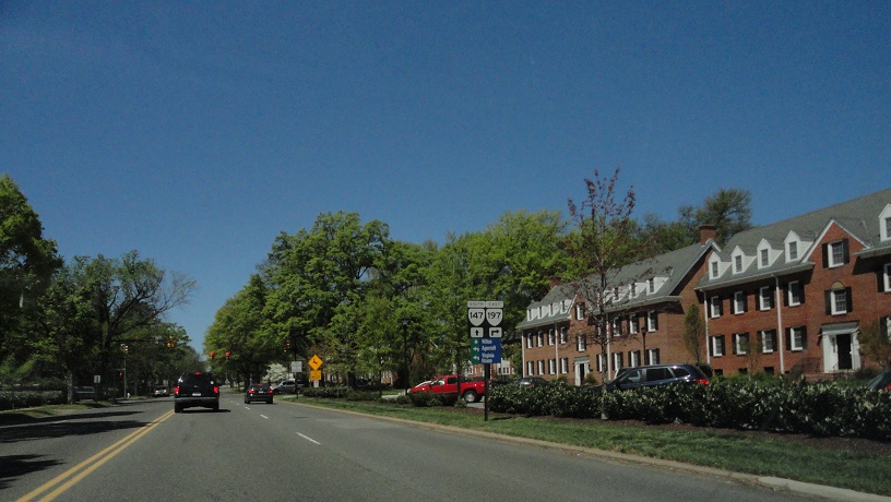

Another erroneous South banner on VA 147 westbound.

I'm now in Henrico County, where VA 147 becomes Huguenot Road. They actually know which way the route is signed.

The Huguenot Bridge is being replaced with a new one.


And guess who's the first non-construction person to go on the new one...

Yeah, it's me. My dad is an inspector on the bridge, and he was working that day, so he invited me out to it since I was in the area. Had I known this was going to happen, I probably wouldn't have worn Chuck Taylors.

Those who are working behind this wooden railing on the bridge are required to wear fall protection, which consists of a harness and a cable.

The end of the concrete thus far.

Looking out from the new bridge to the old bridge.

Watch your step.

That's Riverside Drive down there. It's part of US Bike Route 1.

Work Zone Speed Limit sign.

Who says sports cars can't go off-road?

Now under the bridges.

Looking at the bottom of the new bridge...

...and the old bridge. Look at that corroded steel. Yikes!

Like most bridges, the old Huguenot Bridge has graffiti underneath it.

Back on VA 147, crossing VA 150.

That's a covered-up South banner over the VA 147 shield.

South of VA 150, VA 147 straddles the border of Richmond and Chesterfield County. Street blades on the south side of it are made by Chesterfield, while the ones on the north side are made by Richmond.


Now turning onto Old Gun Road, which is Chesterfield SR 673.

Um, what?

Old Gun Road is another road that straddles the Richmond-Chesterfield border, albeit briefly. It then fully enters Richmond.

Old Gun Road is narrow, curvy and scenic.

Gee, thanks, Richmond.

Descending to near the river.

Entering Chesterfield County, for good this time.

Old Gun Road turns west here at Cherokee Road (SR 704), which enters Richmond not far from here. It carries US Bike Route 1 with it.

Old Gun Road west of Cherokee has US Bike Route 1.

Going uphill now.

Old Gun Road ends at Robious Road, which is old VA 44 and current SR 711. US Bike Route 1 continues west.


Robious Road changes from SR 711 to 675 at VA 147, because VA 44 ended here and Powhatan County already had an SR 675.

The Robious/Huguenot intersection has a railroad crossing in the middle of it.

VA 147 ends at US 60. South of here it becomes SR 653, Courthouse Road, but it has the highest traffic count of any secondary route in Chesterfield County, and still feels like it should be primary.

Seriously, this is a secondary route!

VA 76 southbound from SR 653 now only takes exact change or EZ-Pass.

SR 653 meets SR 604. Eastbound 604 continues as Courthouse Road while westbound is Genito Road.

SR 653 continues south from SR 604 as Qualla Road, then Second Branch Road.

From there I got onto VA 288 and got off at VA 10, so I could try getting a picture of this sign again. This was the third attempt at it.

That's it for now.
No comments:
Post a Comment