Thursday, March 27, 2014

2014 Hampton Roads Meet, Part 3: The Meet Begins

The meet consisted of 13 attendees: myself, Froggie, Mike "Mapmikey" Roberson, Oscar Voss, Mike Tantillo, H.B. Elkins, C. Patrick Zilliacus, Brian LeBlanc, Daniel Greenstein, Laura and Mike Pruett, Michael Temme-Soifer, and Keith Thomas. After lunch we split into four cars: Froggie drove me, MTS, and Keith; Oscar drove H.B., Patrick, and Mike T; Mapmikey drove the Pruetts and Daniel; and Brian drove himself in case he had to leave early.

Leaving the restaurant, heading towards I-64 on Greenbrier Parkway.


Getting onto I-64.


And exiting.
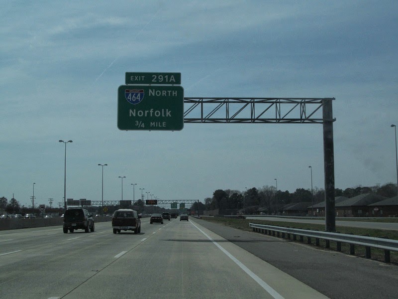

This area of Chesapeake has been under construction on and off for years now. First, the Oak Grove Connector (VA 168) was completed, connecting the Great Bridge bypass with I-64 and rerouting US 17 down former VA 104, Dominion Boulevard. Now, US 17 is being converted to a freeway, with interchanges (heading south) at VA 190 (to be a SPUI), VA 166 (diamond), and VA 165 (SPUI). The first four stops on the tour were all related to this construction.


US 17 used to continue to the left of the hill, but construction of a new high-rise bridge over the Elizabeth River has temporarily rerouted it to the right, over VA 166's southernmost parts.


And here's some bad signage. VA 166 may as well be truncated to this intersection, because south of here US 17 follows it, and after construction is completed it'll be rerouted to hit 17 at Dominion Lakes (which we'll see later).


Despite the span wires and silos, we're still in the suburbs.


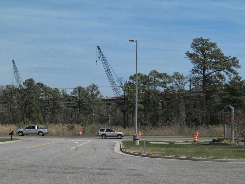
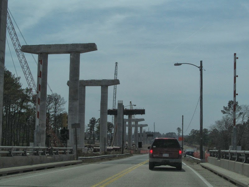
Arriving at the first stop, the bridge construction. US 17 currently uses a drawbridge.


Froggie's Tiguan, Oscar's Prius, Brian's Civic, and Mapmikey's Saturn Aura.


The bridge was opening, so we watched. Traffic backed up quickly.


Back on the road, going over the bridge to the next site.


12-8-8 signal means old.


After the bridge is the future interchange with VA 165.

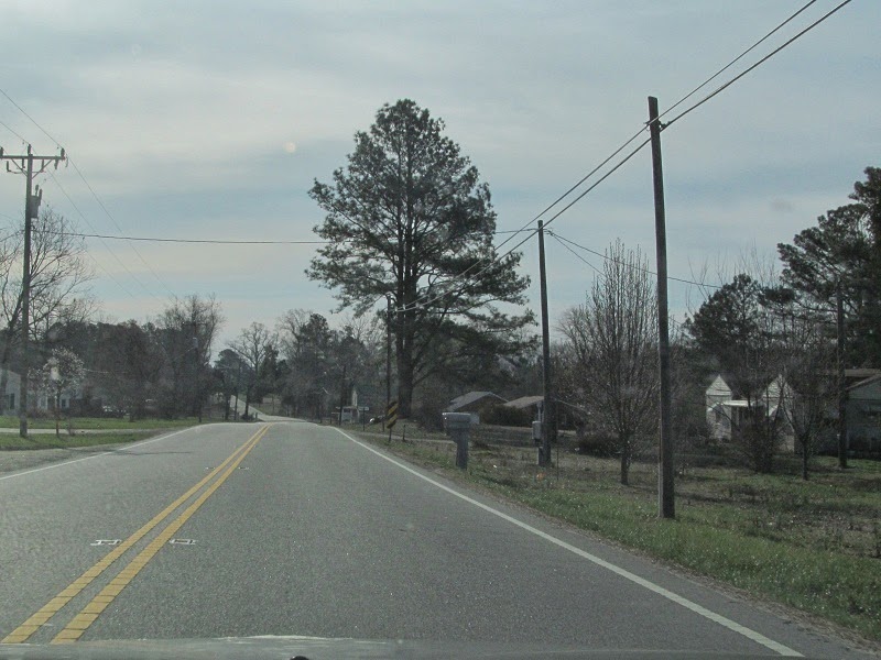
For the next stop, we turned into a neighborhood off VA 165 to take pictures. Two houses were demolished as part of the construction.


The mailbox and driveway entrance from one of the destroyed houses were still present.


After this we got back on the road and went to another vantage point of the same construction. I'll pick up there in part 4.

Wednesday, March 26, 2014

2014 Hampton Roads Meet, Part 2: Temporary Clinching

I headed east (signed northbound)on US 258 and VA 32 between Benns Church and Carrollton, heading towards US 17.


US 17 had more traffic than the roads that preceded it on my journey.


At least until I got to the bridge over the Elizabeth Nansemond River.


From US 17 I got onto one of my favorite roads, VA 164. There's some construction going on near its current east end. It was on the meet itinerary, so I didn't get many pictures of it.


Some terminals. I'm now in Portsmouth.


VA 164 currently ends at this interchange with US 58. Once the Martin Luther King Freeway expansion project is complete, it will be extended to I-264.


After the MLK Freeway ends, there's a detour for VA 141, whose exit was part of the construction. My original plan was to take VA 337 Alternate (hereafter abbreviated to 337A), which is also in the area, but it was closed south of US 17, so I had to take a detour.


Old shields, including a state-name I-264.


Back on 337A. I didn't officially clinch it until later.


After a couple wrong turns at the end of 337A, I ended up back on US 17, heading in the right direction. Here I'm passing VA 239.


Up next was a route I could actually clinch without any hassles, VA 196.


Oops. This was about the only thing noteworthy on the route.


VA 196 is short, ending at US 13/460, Military Highway. This is the original bypass route of south Hampton Roads, dating back to World War II.


US 13 uses the Gilmerton Bridge over the Elizabeth River. The Gilmerton is a drawbridge that's being reworked, seeing closures overnight during the week. It's still my favorite Elizabeth River crossing in this section of Hampton Roads.


After crossing the Gilmerton, I continued on Military Highway to I-464, then I-64 to the Greenbrier Parkway exit, off which the meet was located. I met the other attendees and had lunch in an excellent restaurant called Kelly's Tavern. I'll pick up with the meet tour in part 3.

2014 Hampton Roads Meet, Part 1: What I Missed On VA 10 In 2012

After the Richmond road meet in 2012, Adam "Froggie" Froehlig discussed hosting a meet in Hampton Roads. On March 22, 2014, it came to fruition, bringing along 13 people from across the Mid-Atlantic. As with my first Hampton Roads trip in 2012, I took VA 10 east from the Tri-Cities, but not all the way to Suffolk.

Sunrise over VA 144 in Colonial Heights.


East of its concurrency with VA 106 and 156, VA 10 drops from four lanes to two.


At Spring Grove in Surry County, home to the eastern end of VA 40, the state's longest primary route at over 220 miles. Its west end is VA 8 in Patrick County.


More from Surry County. There isn't much here other than the occasional CDP.


In 2012 I was too busy avoiding tractors to take pictures in this area. This time the tractors were in the other direction.


Now in Bacon's Castle. Mmm...bacon castle.


East of Bacon's Castle is Isle of Wight County, greeting you with the CDP of Rushmere and a 45 MPH speed limit.


Lights weren't flashing, so there was no fire station at the time.


Getting close to Smithfield.


Two different generations of signage, two different names for mainline VA 10.


VA 10's bypass of Smithfield is arrow-straight almost the whole time until it meets US 258.


Going over some water.


Spot the city town limit sign, win a prize.


VA 10 and US 258 meet, with differently designed shields.


There's an exit here, for SR 714, Fairway Drive.


Southeast of there, there's sprawl, although I didn't take pictures of it. I just find it odd that a town as small as Smithfield has sprawl.


At Benns Church I departed VA 10 and stayed on US 258, which takes the useless VA 32 northbound towards Newport News with it. I'll pick up with that in part 2.